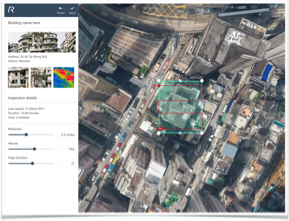
Through the use of satellite data, built-in IoT sensors, and automatic drone inspection, we can effectively assess the potential risk of architectures and calculate the degree of damage after comprehensive analysis of the above data.
In general, our solutions not only provide more accurate inspection and analysis than traditional practices, but also save more than 50%% of the time and cost. Our mission is to create a safer, smarter society through AI inspection technology.

 LiDAR Mapping
 Produce similarly accurate measurement and less costly solution
- Volumetric Analysis
Measurement of volume from dense 3D geometry
- Orthomosaic
True scale - measure true distances. Accurate representation of the Earth's surface
- Digital Terrain Model
For contour generation, orthophoto retification, and flood plain mapping

- Material Recognition
Process monitoring based on material recognition
- BIM vs. As-Built
BIM model and 3D reconstructed model comparison
- CAD Drawing Comparisons
Real-time comparison between the site cross-sections and the CAD design drawings
- 3D Model (mm-Level Accuracy)
Accurate digital reconstruction and the geolocation of each point

- Real-time Obstacle Detection
Computer vision-enabled foreign object detection on comb
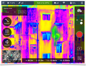
- IoT Structural Sensors
Records seismic and weather data for wear & maintenance calculation
- Big Data AI Inspection
Intelligence to predict inspection and prioritise inspection work
- Autonomous Inspection
Predifined for waypoint for autonomous flight path

Predefined for waypoint for autonomous flight path

Detection for water leakage and surface cracking
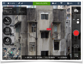

3D laser scanning and crack dimension and dent depth measurement
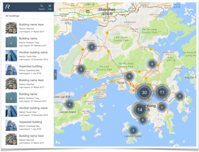

Intelligence to predict inspection and prioritise inspection work
